This variant is proposed to avoid the Portella Blanca pass, located between the Llosa and Campcardós valleys. This pass, at 2,514.9 m above sea level, represents the highest point on the entire route and is covered by significant amounts of snow during the winter months. The alternative route to reach Porta skirts the main ridge flanking the Puigpedrós massif in an easterly direction through the towns of Ordèn, Éller, Meranges and Guils de Cerdanya and turning north through the Querol valley. It has been divided into two sections using the town of Guils de Cerdanya as the central point.
0.00 km (1,030 m). Bellver de Cerdanya, information office of the Cadí-Moixeró Natural Park, in Plaça de Sant Roc; along Avinguda de Pere Sicart and then crossing the Segre River, head northwest to the N-260 road from Puigcerdà to La Seu d'Urgell.
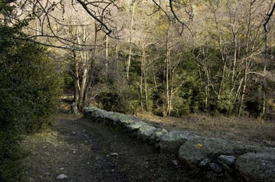
0.46 km (1,017 m) 7 min. Cross the road; on the other side there is a signpost. Continue to the right (NE), leaving the main route to the left (NO) towards Porta, passing through Portella Blanca. One hundred and fifty meters further on, leave the main road and take the asphalted track on the left (NE) that leads to the villages of Ordèn and Talltendre; on this route you will need to take the signposted shortcuts that cut through the loops described by the road. To Cal Codolet, follow trail number 129 of the Cerdanya Trail Network (yellow marks and posts with flags).
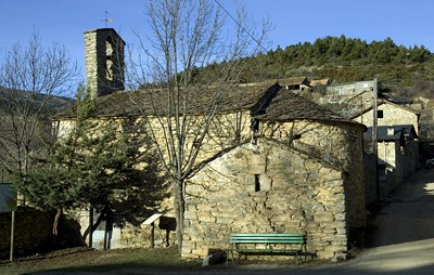
4.47 km (1,478 m) 1 h 33 min. Order, Santa Maria church square. Leave the Talltendre track on the left (W) and continue north along Camí de Cortàs street, leaving the church on the left. Fifty meters further up, take the right (NE) turnoff, following the indications of the Cerdanya Trail Network corresponding to path number 130 (yellow marks) between Ordèn and the Pas d'Éller. The route goes through the coma of La Farga Vella, passes the stream of the same name (5.55 km, 1,420 m) and climbs the eastern slope of the valley to cross the Éller pass.
6.24 km (1,540 m) 2 h 5 min. Leave the wide path and turn left (NE) following the Les Comes path, well signposted by route no. 130, which avoids a wide loop of the Éller road. You cross a small pass, pass a stream and turn east to return to the Vell d'Ordèn path to Éller at the crossroads of the Pas d'Éller (7.68 km, 1,480 m) and the Camí de Cortàs. Continue north, but now following trail 131.
8.65 km (1,427 m) 2 h 37 min. him Cross the town in a N-NE direction, leaving the elevated Romanesque church of Santa Eulàlia on the left. You leave Éller towards Meranges along the Fontanet path, now following the signs for route number 113 and paying attention to the turnoff at km 9.10, where you leave the wide track and take the signposted right-hand turnoff (NE) which, going up the Duran river valley, heads towards Meranges, running through the leafy shade of Valltova.
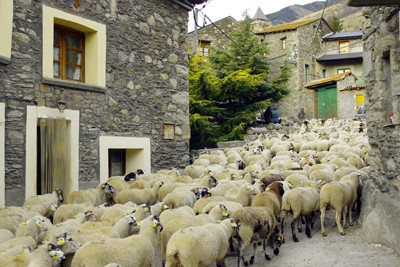
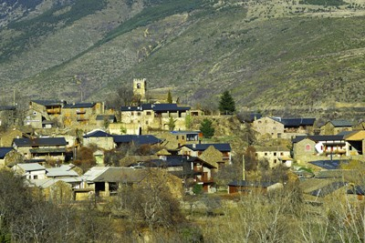
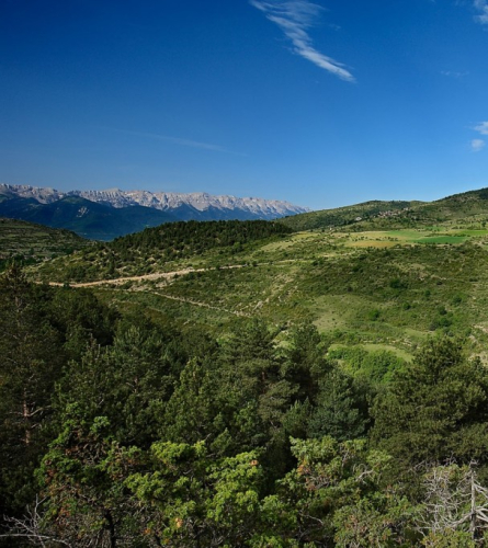
12.33 km (1,471 m) 3 h 32 min. Starts at the Meranges track in Éller. Continue to the right, cross the Duran River over a bridge, leaving the Molí building on the left, and, climbing, reach Meranges among pastures and with good views of the head of the valley, crowned by the thick ridge that extends between the Carbassa peaks, on the left, the Esquella hill, the Engorgs and Puigpedrós peaks.
12.95 km (1,525 m) 3 h 44 min. Meranges; you enter the town via Carrer del Molí. Wide panoramic view of Cerdanya framed, to the south, by the Tosa d'Alp or Pedró dels Quatre Batlles, the Penyes Altes de Moixeró and the Cadí mountain range. In front of the town hall, turn right onto Central Street; at the exit, at the beginning of the car park on the Puigcerdà road, turn left (NE) onto the steep Canes alley (km 13.13), following the signs for route number 116 towards the Poses pass. Further up, the path turns to the SW and rises, little by little, along the coast of La Llampa.
15.30 km (1,731 m) 4 h 30 min. A gentle bend in the ridge marks the Poses pass (called Posa in the official cartography). Confluence with the Gréixer path to La Màniga and Malniu, signposted as itinerary no. 122, which is crossed to go to the Montmalús valley, still following route 116. The view opens to the east, where the Puigmal massif stands out. It turns to the NE, on a gentle descent that soon reverses into an ascent.
15.80 km (1,747 m) 4 h 43 min. Fork. Continue along the path on the right, leveling and then clearly descending, leaving route 116 on the left and continuing along route 141. You cross the Montmalús stream (17.43 km, 1,638 m) after reaching the Montmalús i Gréixer track, next to which, a little further down, you can see a large corral. Continue towards the SW, passing the ridge of the Cabanella mountain range, where you leave the Ger track on the right (S) and, turning again towards the NE, continue along path 141 towards Fontanera. Further down (18.42 Km, 1,707 m). The access to the Cabanella refuge is left on the left; the track goes up.
19.57 km (1,788 m) 5 h 40 min. Turn of the track under the Cabanella refuge (300 m from here). At this point you will find trail no. 116, which will be followed to Guils, and 141 is left. You must leave the track and continue across the meadows along a path that goes in a NE direction. The stream is passed and the path turns to the SW, descending gently to go around the ridge of the Mata de l'Ós mountain range. You pass a cattle line through a fence (21.23 km, 1,685 m) and reach a viewpoint with a good view of Puigmal, Guils and Puigcerdà, where it crosses route no. 231 that goes from Niula and to the Peransalt plain. The path leads to a track that, always downhill, turns to the NE and begins the final stretch of the stage.
24.26 km (1,375 m) 6 h 10 min. Guils de Cerdanya, Plaça Major, end of the stage.