Observations
In Coll de Joux There is a cabin that can serve as shelter if necessary.
Before reaching Orlu, there is the option to continue for about 6 km to Ax-les-Thermes where there are various possibilities for accommodation, catering and thermalism. It is about 2.8 km from the next stage towards Orgeix and about 3.2 km from the access to Ax-les-Thermes. You can download the track and description of this access.
Description
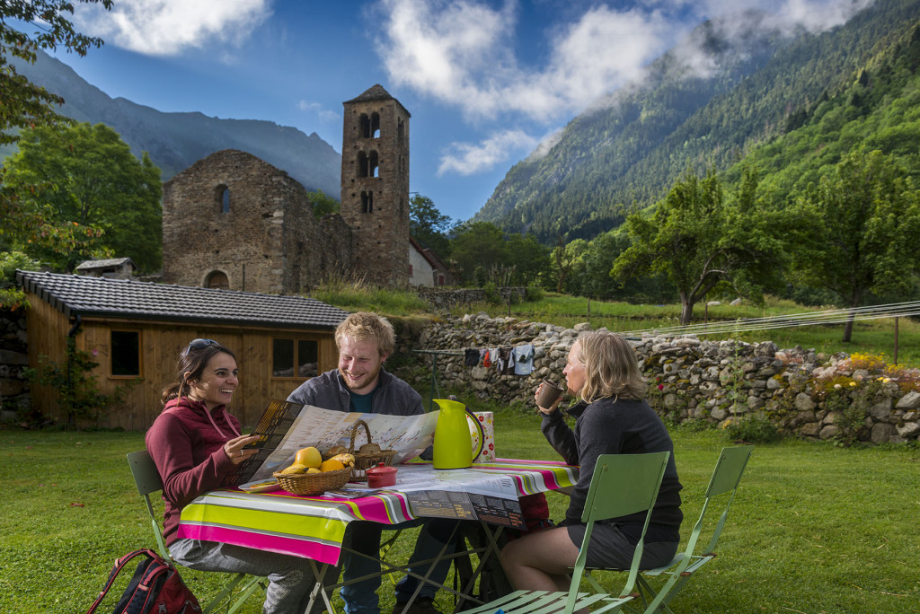
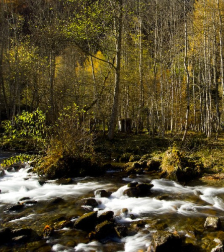
0.0 Km (1,152 m). Mérens-les-Vals. Romanesque Church of Sant Pere, Vives. You must return to the Vives area at the crossroads near some old public washrooms. Here, without crossing the Bridge over the river Le Nabre, From where you came in the previous stage, you must continue up following the course of the Sant Toret River along the west bank, along a track that is initially asphalted but that soon becomes a dirt track. In about 15 minutes the track ends and you must continue along the path on the left which will gain height and also provide good views over Mérens-les-Vals.
0.8 km (1,298 m), 24 min. Fork where the path climbs steeply and describes a sharp bend to the right that you must follow and continue climbing up the bare slope. In a few meters the path climbs a steep slope, just before suddenly entering a small grove.
2.1 km (1,535 m), 1 h 3 min.. It passes by the side of the Coual edges, an inhabited house with a magnificent view of the valley. A few meters ahead you must leave a path on the left and continue going straight up.
About 10 minutes further on, there is a new crossroads where the path leads onto a large forest track. The view is splendid. The GR goes to the right and up, following the wooden signs at this crossroads that mark Jos / Orlu / Orgeix.
3.5 km (1,707m), 1h 35 min You must be careful at two nearby forks, in the first you must follow the main track and leave a secondary track on the left. However, at the next bend you must leave the main track and continue northeast along the more secondary track. Little by little we enter a lush forest.
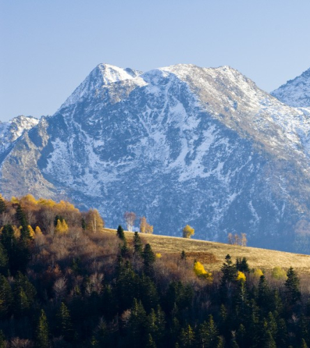
4.9 Km (1,774 m) 1 h 58 min, Serrat de Larguis. Maximum elevation where a splendid and majestic pine tree stands out. You must continue through the middle of the plain in a northerly direction through an elongated space that slopes slightly. Once you have crossed the entire plain, you arrive again in an area of fir trees, where the GR turns sharply to the left and enters a path into the forest.
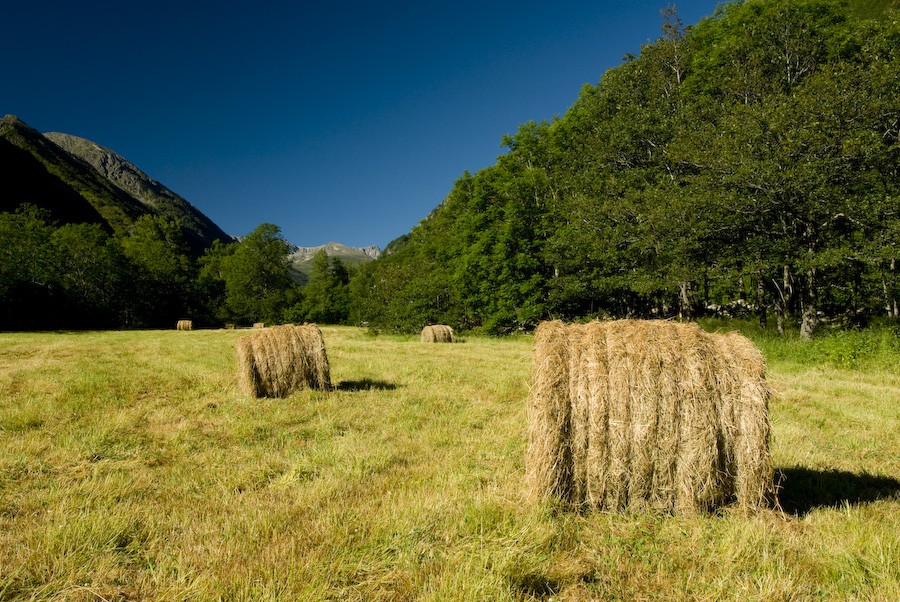
5.5 Km (1,701 m), 2 h 7 min. Coll de Joux. At one end of the pass, where there is a large meadow, there is a cabin that can serve as shelter in case of need. The views are impressive towards both valleys.
You must follow the path that continues east, towards the forest that is a little further down from the cabin. There are indicators on a tree at the beginning of the forest. The path immediately widens and becomes a forest track in the middle of the fir forest. A long zigzag descent that is steep in some sections.
11.3 Km (1,307 m), 3 h 25 min. Cabane du Ressec du Bas, at the foot of the track after making a 90º turn you will find this private cabin. From here the track It goes a long straight line until it finds another cabin, at a crossroads of tracks. You must continue along the straight paved road (in sections it will be paved and in sections dirt).
14.9 Km (992 m), 4 h 14 min. Fork of tracks. After another section with sharp bends, there is a large fork in the trail. You must continue descending following the straight track that goes east.
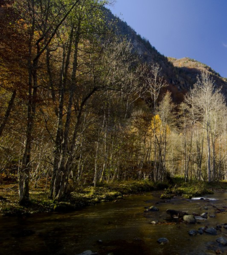
16.7 km (837 m), 4 h 39 min About 100 m before reaching the Oriège river, there is a new fork in the trail. You must continue along the path on the right, which leads on a flat path, following the course of the river, to Orlu. For the next stage you will need to return to this point.
Here you have the option to continue for about 6 km to Ax-les-Thermes where there are various possibilities for accommodation, catering and thermalism. A little further on from Fournit (Km 2.8 of stage 9) leave the GR and follow the access to Ax-les-Thermes (about 3.2 Km). You can download the track and description of this access. here
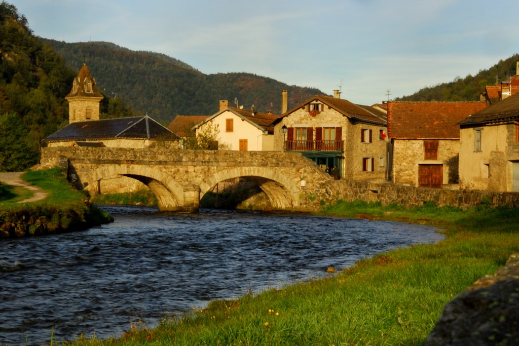
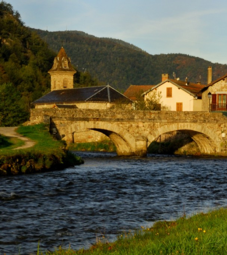
17.8 km (849 m), 4 h 55 min. Once you cross the bridge you reach the center ofOrlu. End of stage
Access to Ax-les-Thermes.
(To have the full description of stage 8, you must follow the entire stage 8 up to the 17.4 Km point. And then continue from point 1.1 Km to point 3.8 Km of stage 9).
Observations
This access is an option for stage 8. Before reaching Orlu, there is the option to continue about 6 km to Ax-les-Thermes where there are several possibilities for accommodation, catering and thermalism. They are some 2.8 km from the next stage towards Orgeix and a little further on from Fournit, follow the access to Ax-les-Thermes (about 3.2 km).
This access is called access to the GR 107 is also marked on the ground as GR (white and red markings).
For the next stage it will be necessary to undo the path and link to point 3.8 of stage 9.
Description
To the total length of the stage, you must add 16.7 km (about 4 hours 40 minutes) from Stage 8 and 2.7 km (about 55 minutes) from Stage 9. TOTAL:
0.0 Km (934 m). To continue towards Ax-les-Thermes, you must follow a path to the east that leaves just outside of Fournier, at the first bend. In a few minutes there is another path that climbs to the left that you must leave, and continue along what is quite flat, until a new crossroads. In this case, the Estagne path goes up, and on the other hand, the Ax path that must be followed begins to descend with a fairly steep gradient. At the next crossroads you must take the one on the left.
1.6 km (818m), 23 minutes. A new crossroads, in this case you must continue descending on the left and in a few minutes you will reach a meadow that you will skirt to the east until you reach the first houses on the outskirts of Ax-les-Thermes. You must follow the main street west, the Entresserre road.
2.1 km (744 m), 32 min. Cross the train tracks and continue along Rue du Martinet which leads to the main road. You must follow it to the right, heading north and towards the river. Passing behind some car parks, you will come out at the roundabout connecting with Avenida Théophile Delcassé. You can see the Church of Sant Vicenç to the east on the other side of the roundabout. It continues but towards the west, already on the right bank of the La Lauze river, just before it connects with the Ariege.
3.2 km (702 m), 47 min. Following Avenue Théophile Delcassé westwards, you will reach the train station. End of the stage.