Observations
For hair For riders, we recommend this horseback riding option that passes through Orlú. Despite being longer and with more accumulated elevation gain, it saves you the ascent from Orgeix via the Portella d'Orgeix pass that is too rocky for the horses.
Observations
This is a long stage, but there is the option to divide it by doing night at the Chioula Refuge so the stages are as follows:
1st part: Orlu at the Chioula Refuge: 12.5 km, 4 hours
2nd part: Chioula Refuge in Comus: 14.5 km, 3 hours 45 minutes
Another option is to start it in Ax-les-Thermes, if you spent the night there on the previous stage or if you arrive by train. It is approximately the same distance as if you start from Orlu. You must undo the 3.2 km of the link and continue from Km 3.3 of the following description. You can download the track and description.
Description
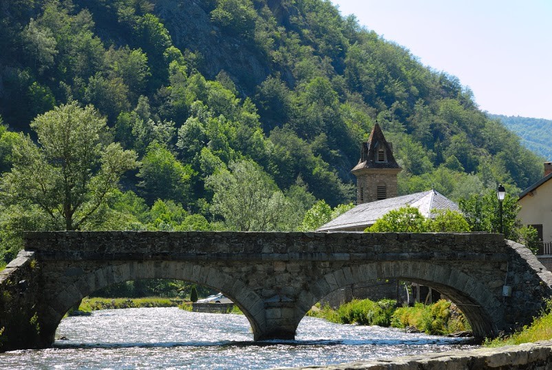
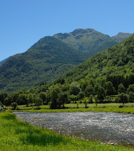
0.0 Km (849 m) Orlu. You must undo the path from the previous stage, cross the bridge over the Oriège river and follow the path parallel to the D22 road but along the left bank of the river.
1.1 km (837 m), 15 min. Fork of the road. At this fork, the previous stage came from the left, so now you have to continue along the track on the right, but only for about 100 meters, because just before reaching the river, you have to follow the path that continues along the left bank of the river towards Orgeix.
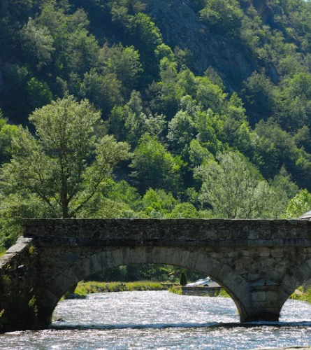
2.2 km (828 m), 31 min. Pont d'Orgeix Cross the Orgeix River over the bridge, then cross the road and continue along the main street heading northwest. In about 5 minutes you will have left the last houses and you must continue along the path that goes up to the right, heading north.
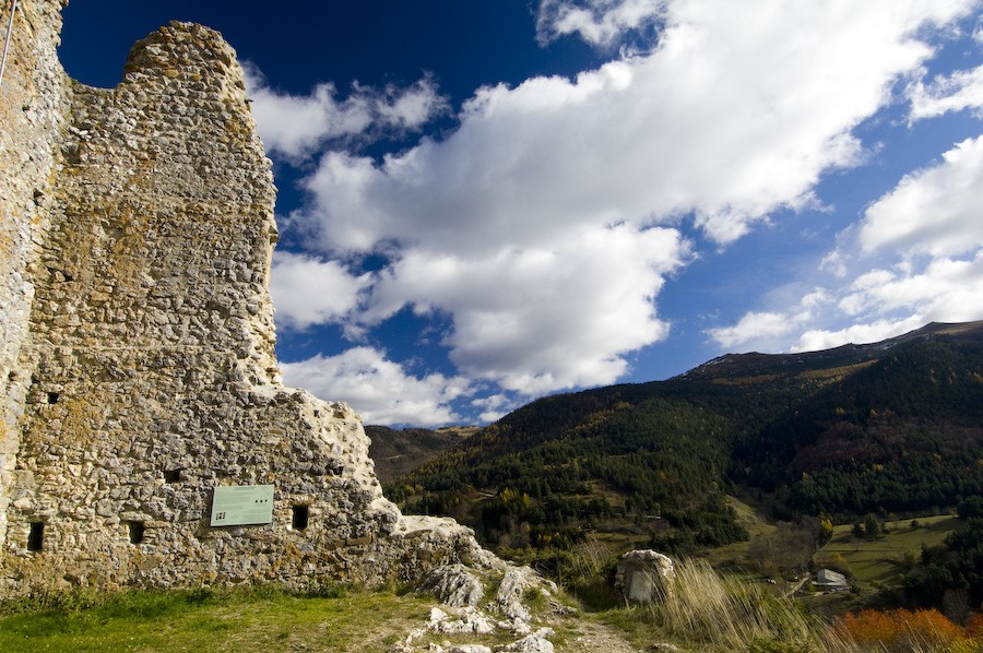
3.2 km (987 m), 1 hour. Portella d'Orgeix. At this point you enter the municipality of Ascou and the path begins to descend in the middle of a leafy forest.
3.8 km (934 m) 1 h 9 min. Once you have passed between the houses of Furnished, with an abundant spring, the path becomes a track that leads to the Ascou road.
About 50 meters further on, there is a new fork where you must continue along the main road.
At this point, however, you can access Ax-les-Thermes in just over 3 km. It is an option if you want to spend the night there. You can download the track and description.
4.4 Km (986 m), 1 h 20 min. road Cross the road and immediately enter the village of Ascou, with the church of Sant Simon in the center.
Once in Ascou, you must cross the entire village and leave it on a secondary road to the north, at the height of the cemetery, on a sharp bend. You have to follow it about 300 m up, with a fairly steep slope.
In about 15 minutes you have to leave the track and enter an entertaining path on the left which will eventually become a path, in the middle of the forest.
6.3 km (1047 m), 1 h 50 min. You reach the village of Sorgeat for a track. When you find the first houses, it is paved. At the entrance to the village there is a GR 107 sign. You must continue towards the interior of the town centre and past the Pircou Fountain Continue along a track to the right, which leaves the town to the northeast. A long and gradual climb begins.
7.5 km (1,143 m), 2 h 12 min. Fork with a wide track, follow it to the left for about 850 m. Then leave it and follow a small path that climbs steeply to the left. Be careful, you have to be careful to see the path, the track continues straight. Initially the path is open, but little by little it will enter a leafy beech forest.
11 km (1,645 m), 3 h 41 min. The slope of the path decreases as it widens until it passes through a clearing where it connects with a forest track, the Ijou Pass. You must follow the track that goes down, towards the north.
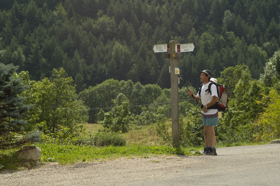
12.4 km (1,601 m), 4 hours. Pla de la Garde. Here you must not get lost, there is a signpost that indicates up to five different paths. A good option if you have time to take a break or want to split the stage is to go to the shelter. Chioula Refuge. To get there you must continue along the straight track and at the next crossroads turn right. It is about 400 m of flat ground, well signposted.
Once you want to continue the itinerary, you must return to this crossroads and continue down the trail on the right. In 10 minutes you reach the Pierre Blanche Pass where there is a new junction where you must continue north, following the track on the left and immediately follow a more secondary track, on the right. Soon a gentle climb begins, passing through Rieufred Pass (1,601m), the Canons pass (1610 m) and finally Balagues Pass (1,671 m), highest point of the stage.
The GR definitively changes slope and begins to descend towards the village of Montaillou. You leave the pass along a path with a steep slope towards the north, which goes into the valley and through which a watercourse passes. Then you reach a crossroads where you find a well-marked path, cross it and continue straight along the path that widens a little.
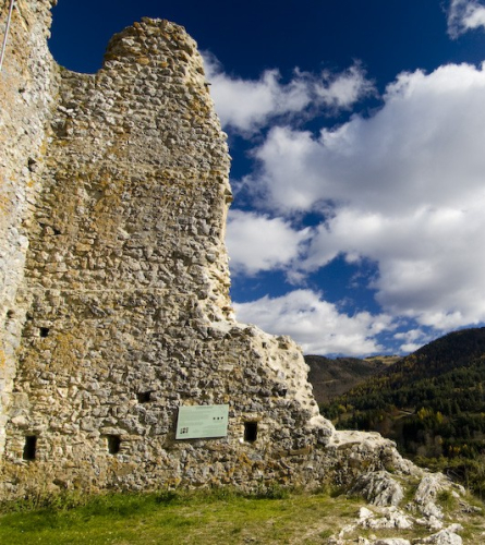
20.5 km (1,319 m), 6 h 5 min, Brulladou mountain range. Crossroads where you must leave the main path and follow the one on the left, which will gradually become narrower. In about 8 minutes you cross a track and the path becomes wider again.
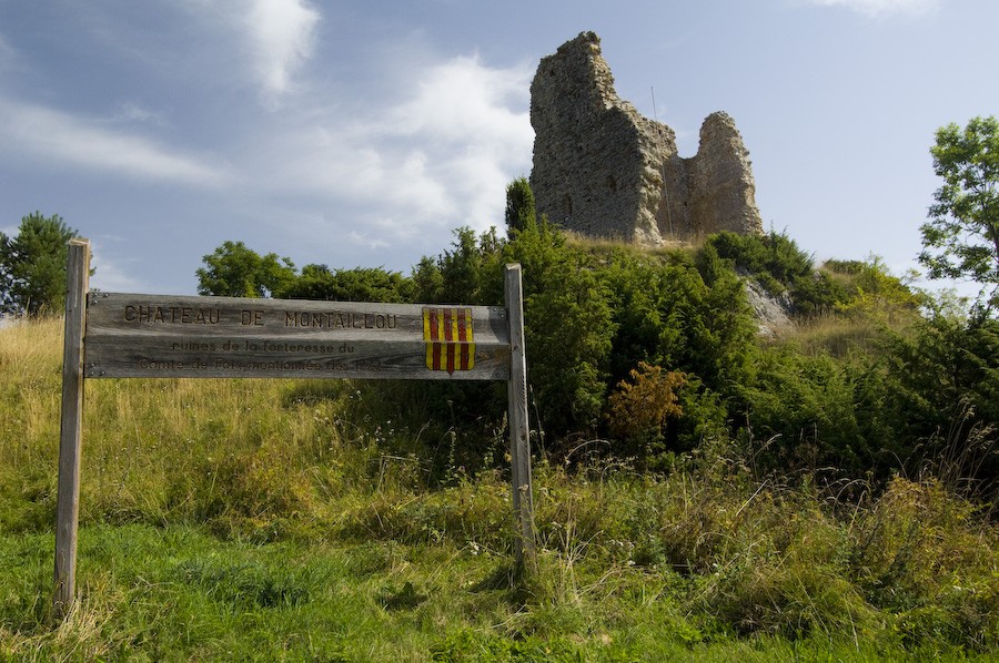
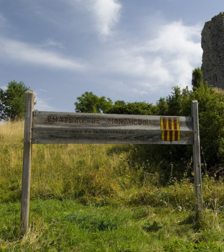
21.6 Km (1,281 m) 6 h 20 min, Montaillou. After passing a fountain, the first houses can be seen. You must follow the track to the right. After passing the church, continue down the main street and once past the last houses, follow a dirt forest track to the left. Just over 300 m later you must leave it and follow the path on the right.
23.5 Km (1,241 m), 6 h 46 min. Meadows. Once you have gone further down, you will begin to see the town of Prades, which you can reach from the east. Cross the road where there is a small square with a fountain, and continue along Prades Street, heading north. If there is time, it is a good place to take a short break before ending the day.
At the exit of the town, continue along the downhill path on the right which initially runs parallel to the road. You leave an asphalt road that goes up to the left.
25.9 Km (1,182 m), 7 h 19 min. Just before reaching a track, you must follow a path to the left. In 5 minutes there is a new crossroads where you must continue to the right, making a 90º turn west and immediately continuing north again.
27.3 Km (1,168 m), 7 h 38 min. Comus. Finally passing in front of the campsite, you reach the D20 road, right at the entrance to the town of Comus. End of the stage.