Observations
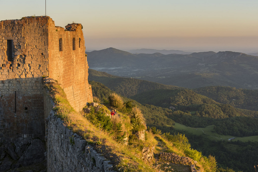
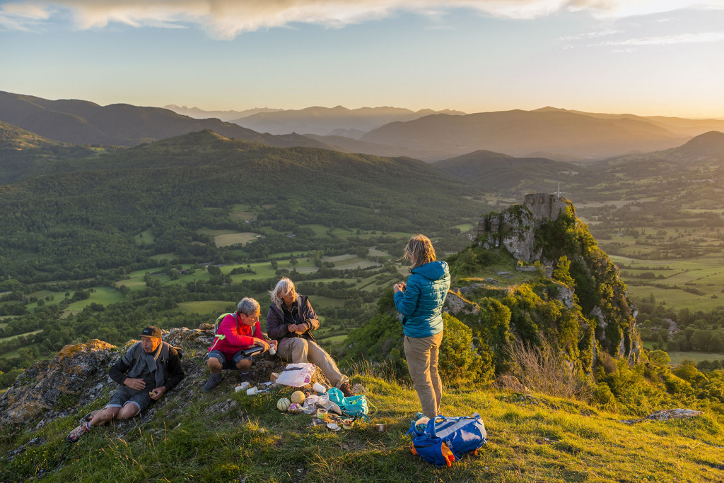
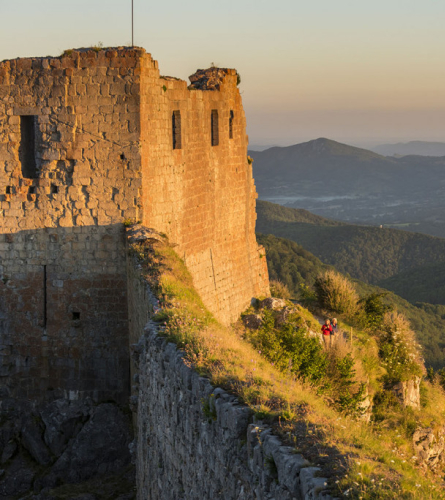
From Montsegur you can continue through Montferrier, until you reach Roquefixada and its impressive Castle. Highly recommended to see the sunset at the castle. The signage that must be followed will be the GRP marks (yellow and red), common marks on the GR 107 of the Path of the Good Men.
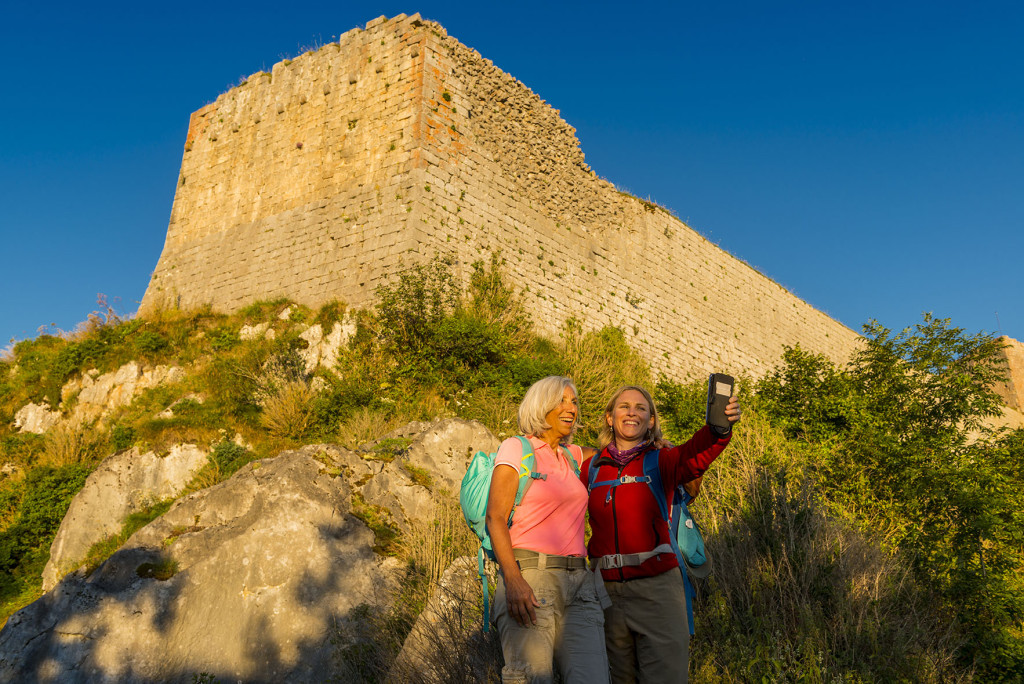
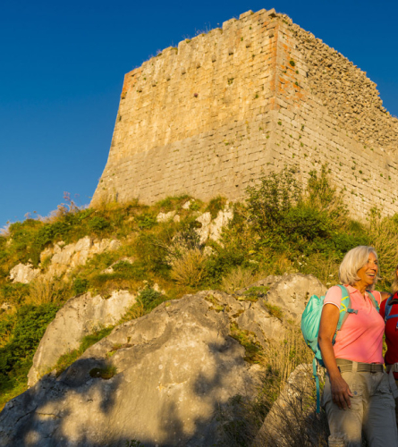
If you haven't visited Montsegur Castle the previous day, it's worth taking the time to do so. It is accessed from Pla dels Cremats at km 1.8 of this stage. To access the castle it is necessary to pay an entrance fee. entrance (Adults: €5.50, Children from 8 to 15 years old: €3, Children under 8 years old: Free).
Description
0 Km (934 m). Montsegur. At the exit of the village, just in front of the cemetery, follow the D9 road towards Montferrier for about 100 m, and then follow the track on the left. In about 15 minutes, you will need to cross this road again to immediately reach Pla dels Cremats.
1.8 km (1,022 m), 20 minutes. Plan of the Burnt. From here the steep path that goes up to the Castle is evident.
It may have already been visited the day before, but if you have time, it is worth doing it.
There is the option of arriving here by car (there is parking). 3 minutes away, by the road).
The GR continues along the path west towards Montferrier. This one enters a wooded area, first gliding and then losing altitude.
1.8 km (1,030 m), 30 minutes. The path leads to the road that you must follow for about 600 meters to the right, until you reach the houses of Marou.
2.8 km (909 m), 44 minutes. At the foot of the road there are a group of houses, Marou. From here a path emerges to the left that you must follow.
4.4 km (804 m), 1 hour 6 minutes. You must cross the secondary road that leads to the Mont d'Olmes ski resort. The path follows the path of a small stream to the village of Montferrier. In 10 minutes you pass by the Bordes of Bas.
5.6 km (732 m), 1 hour 21 minutes. The first houses are found on the outskirts of Montferrier. You must continue straight on the asphalt track until you reach the bridge at the entrance to the town.
6.3 km (695 m), 1 hour 30 minutes. Once you have passed the bridge that crosses the Touyre river, it is advisable to enter the town center of Montferrier.
To continue the route, you must return at this point and follow Mont Forcat Street for a few meters to the left, and at the next fork the Camí de les Escaroles, also paved. From here comes the first long climb of the day.
In 5 minutes, before a sudden bend, you must leave the asphalt road that reaches the last house, and follow the path to the left.
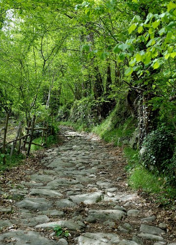
7.2 km (819 m), 1 hour 52 minutes. It is found asphalt road from the village of Le Sau. The path follows it for a few meters but then cuts off, climbing more directly with some cobbled sections.
In 10 minutes you reach the village of The Sau. You must enter and follow the main street until you cross it and continue along the secondary road to the north.
8.2 km (877 m), 2 hours 10 minutes. You pass by a cheese factory. From here the path begins to descend first gently and then more steeply.
10.8 km (595 m), 2h 49 minutes. Junction from where to access the inhabited center of Story. You must follow the track on the right here and immediately cross the bridge over the Douctouyre river. Shortly afterwards, with caution, you must follow the D117 road for about 150 m to the left and just after that, continue along the path on the right that climbs up the Mondini forest.
13.4 km (703 m), 3 hours 32 minutes. Cross the D9A road that goes to Roquefixada, and continue straight on the asphalt road that goes up to the hamlet of Coulzonne.
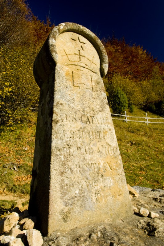
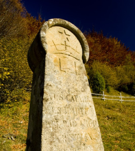
14.5 km (782 m), 3 hours 52 minutes. Once past the last houses of Coulzonne, you must continue along the track that goes northwest. In about 10 minutes you will find a monument of the Battle of Roquefixada. You must continue along the track heading west.
16.4 km (774 m), 4 hours 20 minutes. Arrival Roquefixada. End of the stage.