STAGE 02: From Peguera to Gósol: Connecting the mining past with the heretic villagers
Observations
If in the previous stage you lodged at Cal Barbut You must return to Font del Coix along the same path you took in the previous stage (about 5.5 km) and climb to Peguera, or ask to be taken directly to Peguera, where this stage begins.
If you stayed at Refuge of the Rasos of Peguera, You will first have to climb to La Creu and then go down to the town of Peguera (approximately one hour), following the signs for the PR-C 73 (Sender de Sant Corneli).
You can download the tracks of these accesses and variants.
Description
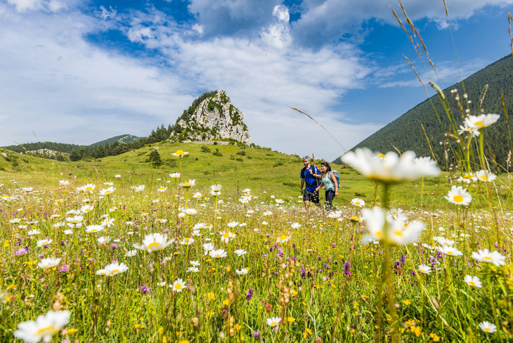
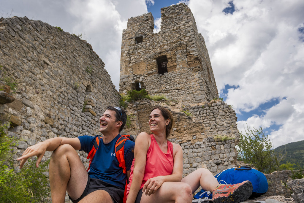
0.0 Km (1,612 m). Peguera. Ancient rural and mining village, currently uninhabited.
Continue west along the track that climbs until you reach the asphalt road. You must follow it a few meters to the left until you reach Ferrús Pass, where there is a new fork in the road. Here you must leave the paved road and follow the track on the right.
2.4 km (1,646 m), 35 min. Crossroads and fork in the road. The Bonner to Feners variant (GR 107-1) is left on the left, with less elevation gain and a little longer.
About 50 m further on is the Witch's fountain (Font de la Bruixa). Continue northwest, towards the walls of Ferrús.
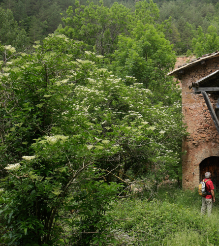
3.3 km (1,650 m), 50 min. Ferrús. An old farmhouse that stands precariously, under the impressive wall of the Ferrús rocks. Continue northwest along a path snatched to the rock and climbing steeply along the Gran de l'Estret canal. It is an irregular and rocky terrain and presents some technical difficulty. You have to be careful.
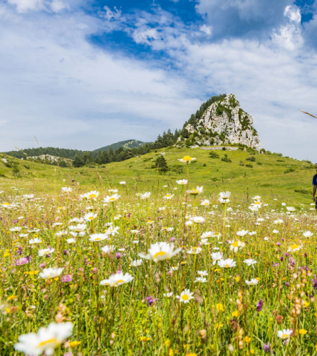
5.4 Km (1,970 m), 1h 43 min. Collet de l'Estret. The biggest climb of this day ends on this pass. Here there is an exposed path that climbs to the right, up to Gallina Pelada which, at 2.320 m, is the highest peak in the Ensija mountain range.
The GR continues along the straight path that descends, towards the west. The trail enters the forest, turns first north and then west, following the rocks. and Orenella's cave, which form a semicircle. Place of special landscape interest.
7.1 Km (1,830 m), 2 h 8 min. Coll del Portet You will reach a track that you must follow to the right, north, for 700 m, until you find the Portet fountain. Here you leave the track to follow a path to the left that descends steeply through the magnificent red pine forest of the Berry of the hares (Baga de les llebres), then skirting the Sant Telm rock. After a while, the Pedraforca massif and its spectacular south wall become visible.
10 km (1,387 m), 6 hours 12 minutes. Forest trail. The path ends at a track that you must follow to the left, westward, for about 950 m. Then you must follow the path that goes down through the forest until you reach the Molí de Feners, where it ends at a track.
11.9 km (1,000 m), 6 h 29 min. Feners track. Here we find the variant 107-1 that was left before Ferrús. After crossing the bridge, you must follow the path that climbs west following the Aigua de Valls river, which comes from Gósol.
If you want to visit the village of Feners, you just have to continue up the track, and in a few minutes you will reach it, from there a track returns to the GR. From here, the stage can be shortened with the help of a vehicle that provides transportation to Gósol.
12.4 Km (1,222 m), 3 h 36 min. Track. It connects with the track coming from Feners. You must follow it to the left towards the Forge (Farga). Then, without crossing the bridge, you must climb the old path that goes up to Espà.
13.3 Km (1,320 m), 3 h 56 min. Espà.Small and cozy village currently an extremely quiet place. You must cross it and go up to the B-400 road that connects Guardiola de Berguedà and Gósol. You will have to follow it to the west for about 50 m, and then immediately leave it and continue along the track on the left that leads to another hamlet, Sorribes.
15 Km (1,350 m), 4 h 22 min. Sorribes. You enter this small town and cross it in a northerly direction, going again towards the Gósol road, but halfway up, you must follow the path to the left that runs between fields. In a few meters this turns into a trail and climbs to Cap de la Creu.
16.1 Km (1,439 m), 4 h 43 min. Cap de la Creu Pass. Here it connects with the PR that goes around Pedraforca. It is worth taking a detour to reach the viewpoint where panels will show the surrounding mountains.
To continue towards Gósol, you must follow the wide path in the opposite direction to the viewpoint, which reaches Gósol on a flat path. At the entrance there is a roundabout, you must follow the main street that will lead to the Plaça Major.
17.5 km (1,426m), 5 h 15 min. Gósol. End of stage
Access to the Rasos Refuge in Peguera in Peguera.
(To have the full description of the stage you must follow all of stage 2 after this access)
As in the previous stage, you will need to follow the white and yellow markings of the PR-C 73.
Description
For the total of the stage, the total 17.5 km of Stage 2 must be added.
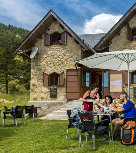
0.0 Km (1,755 m). Rasos Refuge in Peguera. You must follow the PR signs that continue along the paved road to the north, a few meters before the bridge, where you will need to follow the path that goes off to the right. This path cuts across the road that goes up to Els Rasos, which you will have to cross twice. This indicates that it is a steep path, although it is about 700 m, you need to take it easy.
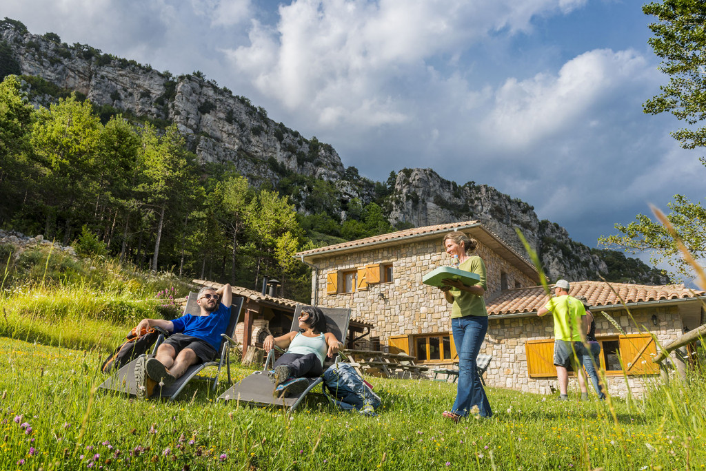
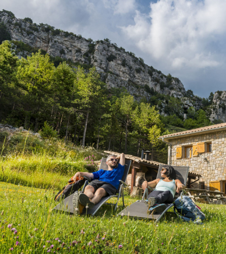
0.7 km (1,892 m). Sant Crist Hill. This pass where the road reaches is home to the old Rasos de Peguera ski resort. Depending on the time of year, you will find an open bar where you can stop if you need to before continuing.
You must follow the track that comes out at the end of the car park, which descends sharply towards the north. It passes through Catllarí pass where there is a pond and on a bend in the road, just before the track is paved, you will find a fork in the road. You must follow the path that climbs a little to find the path that goes straight down to the town of Peguera.
3.6 Km (1,612 m), 1 h 4 min. Peguera.Once in the town of Peguera, you can follow the GR marks, and follow the description of stage 2 from the beginning.
BONNER VARIANT:
(To have the full description of the stage you must follow to the 2.4 Km point of the description of stage 2. And after the variant continue to point 11.9 Km also of stage 2)
Observations
This variant recommended for bicycles and horses, offers a less technical path than the climb to Ferrús is a fairly technical, with loose stones. Although it lengthens the stage a little in kms, as it has less elevation gain and is an easier path, can approximately involve the same time. It also allows you to enter one uninhabited areas of great interest.
The stage is also signposted with white and red markings as GR 107.1.
Description
To the total of the stage, we must add 2.4 km (about 35 min) of the initial stage 2 from Peguera and about 5.6 km (1 h 35 min) from the end to Gósol.
0.0 Km (1,646 m). Crossroads. Here you must follow the track on the left towards Bonner.
1.5 km (1,493 m), 21 min. Right at the entrance to the house the Plain (La Plana) there is a four-track fork, you must continue descending straight.
2.1 km (1,510 m), 31 min. Once you leave the house Cal Sec On the left, there is a new intersection of tracks, you must continue straight south, but be careful because in a few meters you must follow the path that begins to climb to the right, following the GR marks. Until Portelll de Graells you are in the Solsonès area.
3.4 km (1,615 m), 54 min. It reaches the Portell de Graells, in the middle of a lush forest. Throughout this section you will need to be alert to the markings as forestry work has opened up multiple trails.
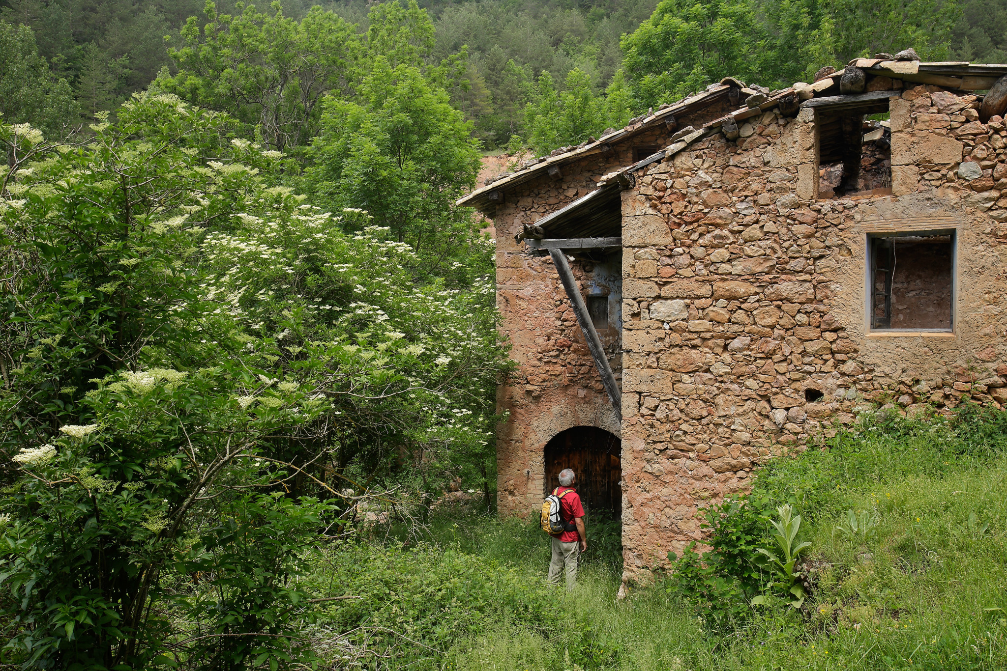
6.9 km (1,304 m), 1 h 43 min. Once you have descended the entire coast, you reach the Bonner River that the track crosses. The ruins of the old village can already be seen to the west.
7.6 km (1,331 m), 1 h 54 min. A good place to stop and contemplate this area, which is currently uninhabited but which we can imagine with much more human life a hundred years ago.
To continue, you must follow the main trail. From here it will descend to the Molí de Güell. In about 15 minutes you reach the Castellar Pass.
9.8 km (1,105 m), 2h 26 min. Past the house of the Feixeta, the path has just descended to the Güell Mill (Molí de Güell) Here you can see how a few meters downstream the river uses the power of water to generate electricity.
You have to cross the Aigua de Valls River, by the bridge. From here we continue upstream along its right bank. First, however, you have to climb the track that smoothly follows the canal through which the water from the hydroelectric power plant flows.
10.6 Km (1,190 m), 2 h 43 min. Main track. Here there is a variant to climb to Gósol passing through another abandoned hamlet nearby, Moripol, but in this case the proposal is to continue towards Feners following the track and canal, on the right.
In about 7 minutes you pass through a tunnel dug into the rock to make the channel (and the track) flatter. A few meters further on, the trail crosses the river and now follows it along the left bank, along the Malpas Bridge.
12.4 km (1,198 m), 3 h 9 min. GR 107 link. Just before the bridge where the waters of the Ruixol torrent which comes from Feners to the northeast, with The Water of Valls which comes from Gósol to the northwest, connects with the main route which comes from a track on the right.