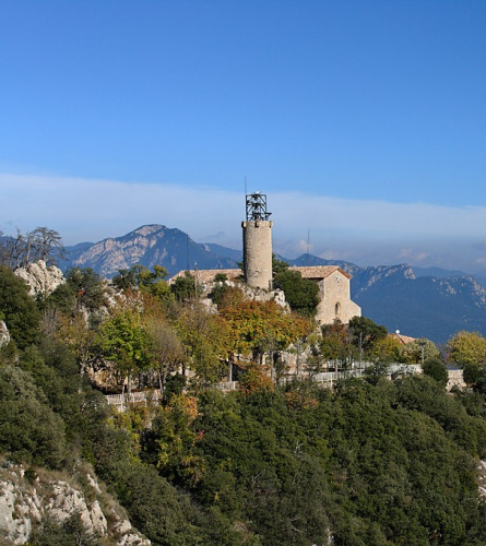
Stage 01: From the Sanctuary of Queralt (Berga) to Peguera: between troubadours and venerated virgins
Observations
From Berga to the Sanctuary of Queralt, where the Camí dels Bons Homes (GR 107) begins, you can walk up, in about 50 minutes, following the PR C-73 (trail marked with white and yellow signs) that leaves from the car park behind Sant Francesc (Torre de les Hores).
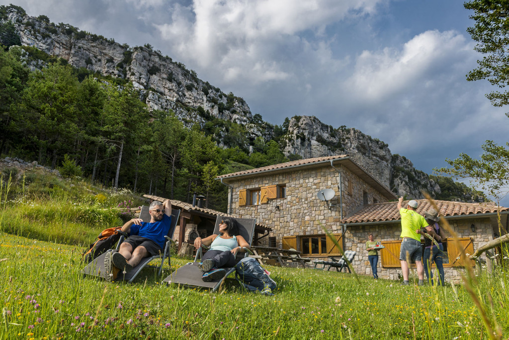
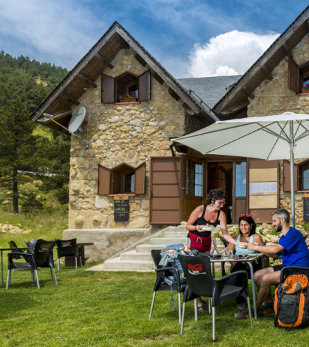
If you sleep at Cal Barbut you have to take a detour a little before Font del Coix Peguera, about 5.5 km (approx. 1 h 20 min.). If you make a reservation, you can ask to be picked up to save you those kilometers, some of which are on asphalt. Above all, book this transfer in advance because there is not telephone signal in this point!
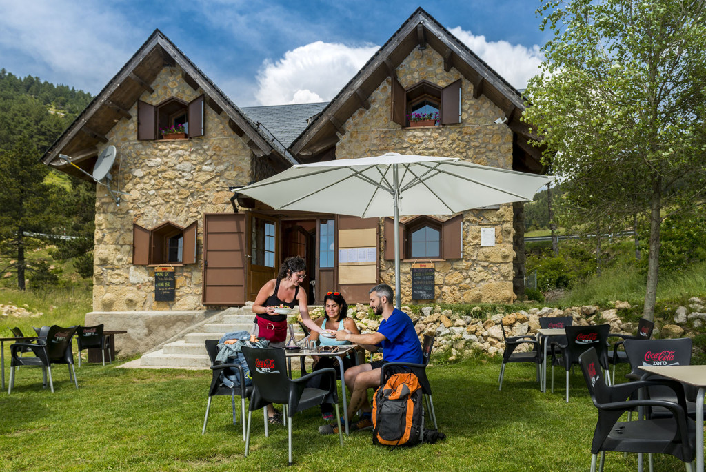
Another accommodation option in this first stage it is the Refuge Rasos de Peguera.To get there, it is better to turn off at Espinalbet (at Km 2.4) and follow the PR-C 73 (Sender de Sant Corneli), it is about 9 km to the Refuge.
In case you spend the night in these accommodations a little bit away from the GR 107, we reccomend that download the tracks of the entire stage and the access tracks from the Font del Coix to Cal Barbut and from Espinalbet to the Refugi dels Rasos de Peguera
Description
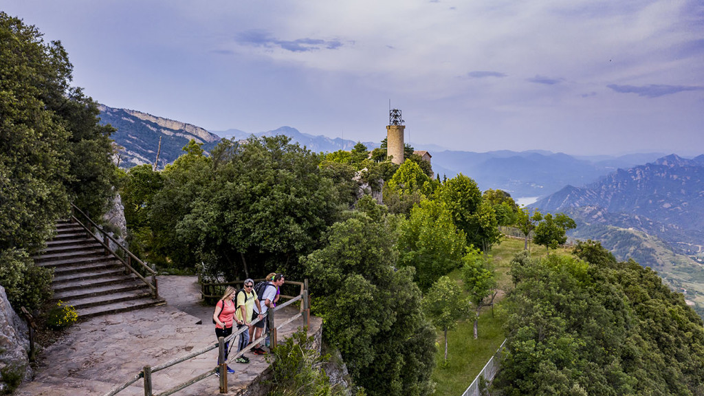
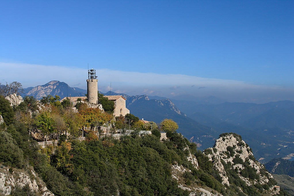
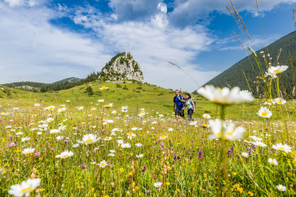
0.0 Km (1,120 m). Queralt Sanctuary. You must go to the esplanade in front of the church. A monolith marks the beginning of the path. You must head west following the vertical and horizontal signs of the GR 107 to find the path.
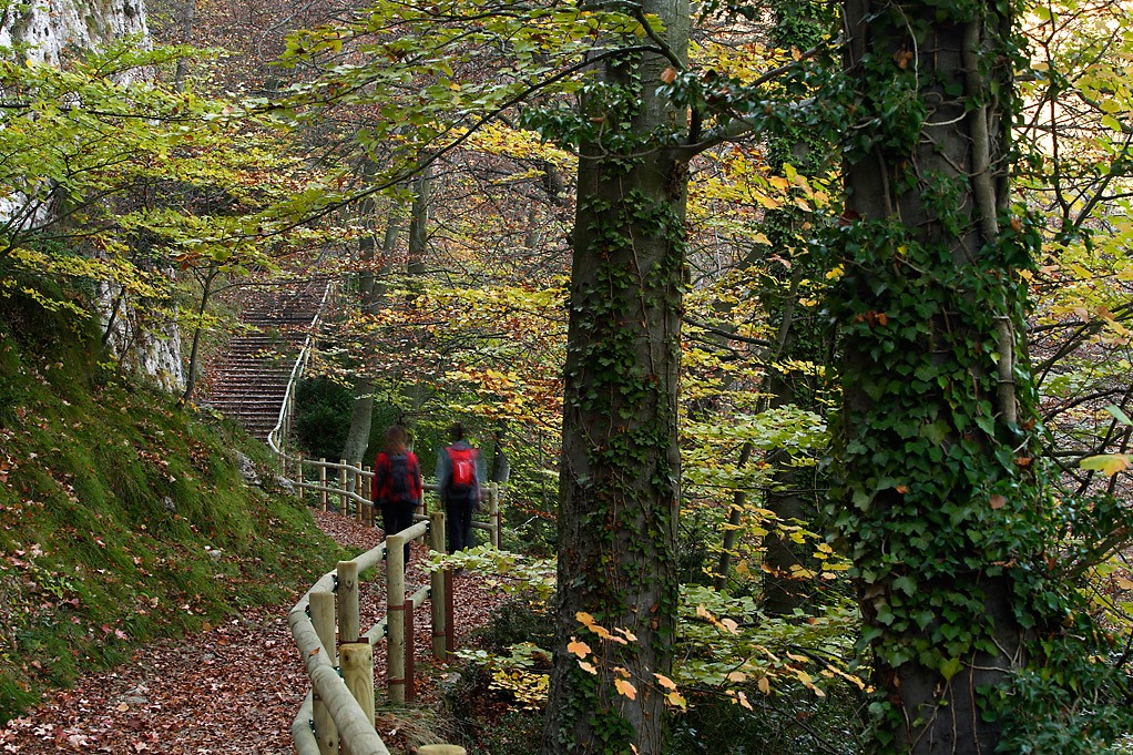
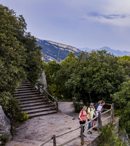
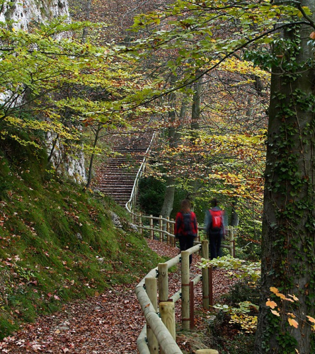
Leaving the access road to the Troballa cave (a curious modernist building and chapel with sharp shapes), you must follow the stairs that go down on the right along the shady path that enters a thick forest with some beech trees. About 400 m later, before reaching the Capella de Sant Joan, you must follow the path that continues to the right and will take you along the north face of the Serra de Queralt.
2.3 km (1,123 m), 41 min. Urbanization. The first houses of Espinalbet are found. You must follow the paved track a few meters to the left and at the next turning follow it to the right.
In this second break, If you want to go to the Refugi dels Rasos, you must follow the paved track on the left (yellow markings) towards the Camping, where it connects with the PR-C 73.
2.9 km (1,172 m), 52 min. Road BV-4243 from Berga to the Rasos de Peguera. You must follow it for about 80 m to the left and then continue along the track that goes up on the right towards Espinalbet. In a few meters you will have to turn off onto a path to the left.
3.2 km (1,235 m), 53 min. Saint Vincent of Espinalbet. It passes through the middle of the small village of houses. When you reach the cemented track, if you follow it to the left, in a few meters you will find the Font d'Espinalbet. The GR climbs towards the church. From there, a path leads up to the meadows below the Our Lady of Corbera. On the plain you need to look for the forest track and follow it to the right until you find another, wider one that comes from the Sanctuary and you also need to continue to the right.
4.5 Km (1,413 m), 1 h 23 min. Coll d'Oreller. Crossroads of tracks and paths. You must follow the trail furthest to the left. closed with a car chain. This goes back to the plains of the Lake.
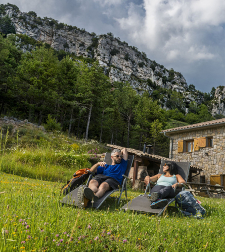
5.5 Km (1,499 m), 1 h 34 min. L'Estany/ The Lake. Leave the Mas l'Estany to the west and also the track, and continue along a wide path to the right, which borders the Pla de l'Estany. It is an extensive grassy plain surrounded by forested mountains that hosts an interesting large pond, which only has water during periods of thaw and heavy rains.
6.6 km (1,485 m), 2h 12 min. Nou Comes Pass. Change of direction. We now continue northwest along a path that descends through the splendid Baga de les Nou Comes, a shady, humid and thick forest, full of beech trees, oaks, boxwood and moss. There are good views to the east of the Cingles and the Soleia de Confós, and, to the north, of the Solana de Peguera.
8.3 km (1,400 m), 2 h 37 min. Bifurcation. After the detours that the path makes to ease the unevenness, it leads onto a wider path, the Camí dels Planos. You must follow it to the left, now level, towards Peguera. It follows the route of the old train that carried coal from the Peguera mines to the collection point. A small tunnel or mine is passed. At the end of the flat section, you cross a stream to climb back up a path to the Peguera track. In the middle of the path there is a small fountain.
9.5 Km (1,388 m), 3 hrs. Track that you must continue to the left. Further on, in a place where there had been some flats for the mine workers, there is a new fork. In this case with the path that goes directly up to Peguera. The GR follows the track to make it more progressive.
11.2 Km (1,586 m), 3 h 30 min. Forking of tracks. You must continue along the path that crosses the stream and shortly after you will find the abundant fountain, Font de Cal Coix.
If you are staying at Cal Barbut, you must turn off here and continue along the track that climbs to Coll de Fumanya. For the next stage you will need to return to this point to reach Peguera. If you are interested you can download the track.
11.8 Km (1,612 m), 3 h 38 min. Peguera, a former rural and mining village, currently uninhabited. End of stage
Below we explain how to get to the 2 accommodations that are at this stage but not quite there. on the GR:
Access to Cal Barbut
(To have the full description of the stage you must follow to the 11.2 Km point of the description of Stage 1)
To access the Cal Barbut accommodation, you must turn off just before Font del Coix, before reaching Peguera. Most of the route is marked as PR-C 73 (white and yellow markings). There is also the option of saving yourself this journey, the accommodation offers pick-up at this point. However, it is necessary to specify this beforehand since mobile coverage in this section is poor. For the next stage you will need to undo the path or have them take you back by car to this point or to Peguera where stage 2 begins.
Description to Cal Barbut
To the total of the stage, you must add 11.2 km (about 3 hours 30 minutes) from Stage 1.
0.0 km (1,586 m). Before crossing the stream, you must follow the trail on the right that climbs north, instead of continuing towards Peguera as you do at the end of stage 1.
If you need to rest a bit first, it may be a good option to continue to the Font de Peguera (3 minutes), where you can also refresh yourself and replenish your water supply.
1.3 km (1,646 m), 21 min. After passing the remains of some old mining buildings, following the track on the right, without reaching the road, you arrive at Fumanya Cross Pass where the climb ends. Here you must follow the track on the left to the Casa de la Creu de Fumanya, 10 minutes away.
Once past the house, you must follow the track on the right, passing under an electric line.
3.8 km (1,457 m), 55 min. New intersection of tracks, where you must follow the one on the left towards Fumanya for about 200 m until the next intersection right at the edge of the open sky of the Mina del Pasqual, where you must also follow the track on the left.
4.5 km (1,458 m), 1 h 6 min. You must leave the track 50 m before reaching the road and continue along the path on the right. In a few minutes this leads back to a track, which you must follow to the left, now to the road.
It follows the road BV-4025 on the right about 400 meters and you will find the crossroads where Cal Barbut is indicated.
5.4 Km (1,433 m), 1 h 22 min. Cal Barbut
Access from Espinalbet to the Refuge dels Rasos de Peguera.
(To have the full description of the stage you must follow the description of stage 1 to the 2.3 Km point).
To access the accommodation at the Refugi dels Rasos de Peguera, if you do not have someone to provide transport from Peguera (end of stage 1), a good option is to turn off at the Espinalbet urbanization and continue along the PR-C 73 (white and yellow markings). You will skip the Nou Comes Beech Forest, but you can enjoy an equally rewarding and interesting journey, passing by the emblematic Pi de les Tres Branques. Another option would be to follow the PR-C 73 from the Queralt Sanctuary, a slightly more exposed path that skirts the Serra de Queralt.
The next stage will need to be extended a little to reach Peguera, where stage 2 begins.
Description
To the total length of the stage, you must add 2.3 km (about 41 min) of Stage 1 from the Queralt Sanctuary.
0.0 Km (1,131 m). You must leave the GR marks and follow the yellow trail network marks that continue along the asphalt road to the left, towards the campsite.
1.0 km (1,233 m). 20 minutes. Once past the campsite, you reach the road to the old Rasos de Peguera ski resort. From this point you must follow the white and yellow markings of the PR-C 73, initially along the track that runs parallel under the road in a southwesterly direction.
At the next crossroads, the PR connects with the variant that comes from the Serra de Queralt ridge. You must follow the path to the right until you reach the paved track of Pi de les Tres Branques.
2.5 km (1,320 m), 46 min. Col de la Creu de Campllong. After a barren stretch of interesting terrain, you reach the paved road. Following it for about 10 minutes to the left, it leads to the emblematic Three Branches Pine. If you want to go a little further, you will find the directions to get to Pi Jove. (young pine)
To follow the route, you must continue on the asphalt road for almost 1 km more.
4.0 km (1,272 m), 1 h 6 min. You must leave the paved track and continue along the track on the right towards the Casa del Riu.
5.4 km (1,285 m), 1 h 27 min. Just before arriving at the house River, once you have crossed a stream, you must follow the path that begins to climb to the right. First you go through an open section, which will gradually close into the Scots pine forest. It has some sections with a steep gradient.
6.6 Km (1,505 m), 2 h 2 min. Sant Llorenç dels Porxos. The location of this small Romanesque hermitage does not leave anyone indifferent. It is worth taking the 5-minute detour to the hermitage before continuing along the path that leads to the Porxos house. Once past the house, the path continues climbing until it reaches a secondary track in 10 minutes. You just have to cross it and follow the path that comes out a few meters further to the left, which continues heading north.
7.3 Km (1,621 m), 2 h 21 min. Collada de Comabona. Here the path leads back to a secondary track, which you must follow to the right. A short respite descending, before resuming the last climb to the refuge. This will begin at the next fork in the road, which you must follow to the right.
8.3 Km (1,688 m), 2 h 40 min. Torrent of Comabona. The path will have become increasingly narrow until it becomes a path. You have to cross the stream and here is the last climb before reaching the Refuge.
8'7 Km (1,755 m), 2 h 52 min. Once you reach the road you can see the Peguera Rasos Refuge about 100 m to the north.